During the summer of 2017, we traveled the Santa Fe Trail from the Santa Fe Plaza in New Mexico to the trail head in Franklin, Missouri and back again. When we got home to review the photos and video of all the places we’d explored, we were exhilarated from all we had learned and discovered, with a newfound understanding of how the American west came to be. This was a trip of a lifetime … so much more than we could ever have imagined.
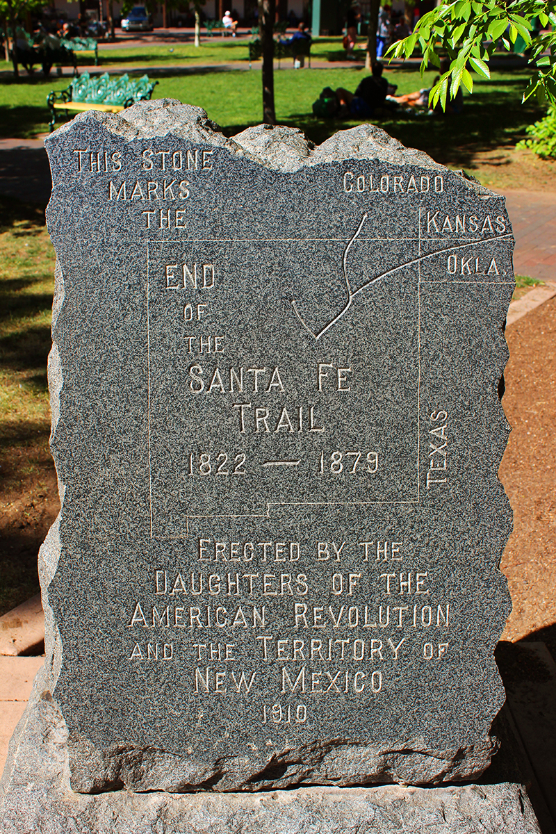
(Pictured: the marker of the trail’s end on the Santa Fe Plaza)
We stood at the trail’s beginning and end, stayed in small towns that embraced their heritage and seemed unchanged since the 1800s, toured an enormous adobe fort and small regional museums, outran a tornado in Kansas and avoided a summer 8-inch hail storm in New Mexico, toured an amazing museum of American Indian history and art, sought out authentic Contesoga wagons, met people who had wagon ruts on their property, others who had very mixed feelings about Manifest Destiny, and yet others who had no idea they lived on the trail and were as curious as we were as to what it was and how it evolved. Every day was more fascinating than the next, and we will talk of this trip for the rest of our lives.
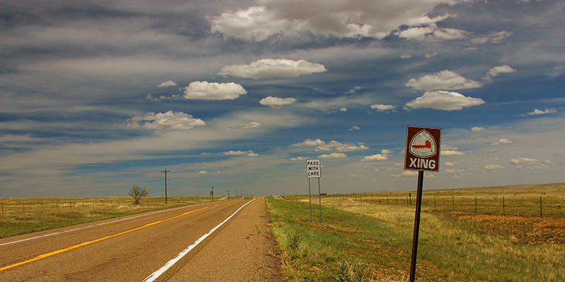
(Pictured: a crossing sign on a remote highway where the indentations of wagon trains came in from the east, crossed this road and continued on westward.)
The idea to follow the trail came when we were planning to drive from Southwestern Colorado to Missouri to visit family. Our typical route was to take Interstate 70 that is the fastest way through Kansas and on to central Missouri. Then it occurred to us … we live not 4 hours from Santa Fe, the end of the trail. Our family lives only 25 minutes from the trail’s beginning in Franklin, Missouri.
“We have to explore this … but what exactly is it???” we wondered. Oh, wait a sec. It’s a cattle trail, right?
According to the Santa Fe Trail Association, the number one misconception is that it was a cattle trail. It was actually a route of trade and commerce between America and what was then Mexico. It’s astonishing how fast things progressed in 1821: Missouri was admitted as the 24th US state on August 10th and was the furthest US territory west of the Mississippi; on September 27, Mexico gained its independence from Spain opening up trade with America; and William Becknell, the father of the Santa Fe Trail, immediately left Franklin, Missouri for Santa Fe, Mexico arriving November 16, 1821. Traders traveled back and forth, then it became a route for pioneers wishing to start a new life in the west. It was also a military trail, and then in the late 1870s as the railroads came into play, so ended the Trail Days.
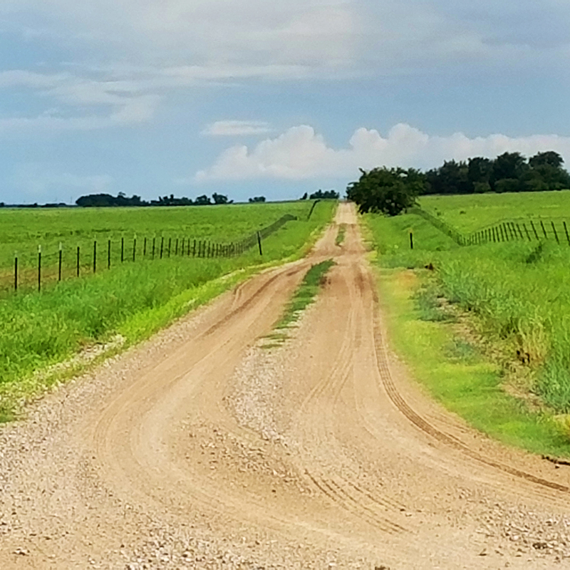
Another false assumption we had is pictured above. We seriously thought the existing parts of the trail would look like dirt roads with two-tracks from the wagon ruts, and that most would have been paved over by highways by now. Not so. After almost two-hundred years since the trail began, most of it is now covered with grass, trees and tall weeds. Pictured above is what it does NOT look like.
So what do you look for instead?
Swales, we were told.
What the heck are swales?
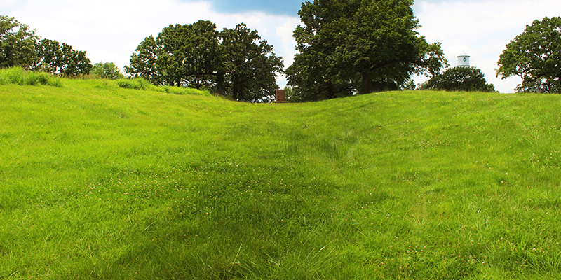
(Pictured: Minor Park swales, Kansas City, Missouri)
Ruts are two-track marks from wagons and oxen/mule teams.
Swales are deep impressions made by thousands of travelers over the years.
Here we are standing in the center of a deep, wide swale from wagon trains. Swales can be up to 20 feet wide where sometimes four wagons ran side-by-side crossing the land, carrying up to 5000 pounds of freight pulled by mules or oxen teams. The weight of the wagons, plus the multitudes of emigrants, traders and animals, left their deep mark in the land. The wagon trains were departing from Kansas City near this spot and the trail is easy to see with the wide groove in the land. Also the vegetation that grows in swales is a different color and texture than the surrounding prairie. (We also found strawberries and wild onion plants growing from the original trail days.)
Once we found our first set of swales, we could spot them along the landscapes from lush green Missouri to the red earth desert of New Mexico. There are countless markers for swales / ruts, and we are now official ‘Rut Nuts’.
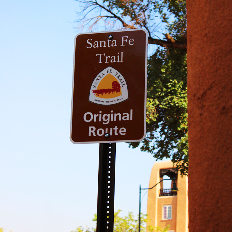
Always exciting to see one of these signs indicating when you are driving on the actual trail route.
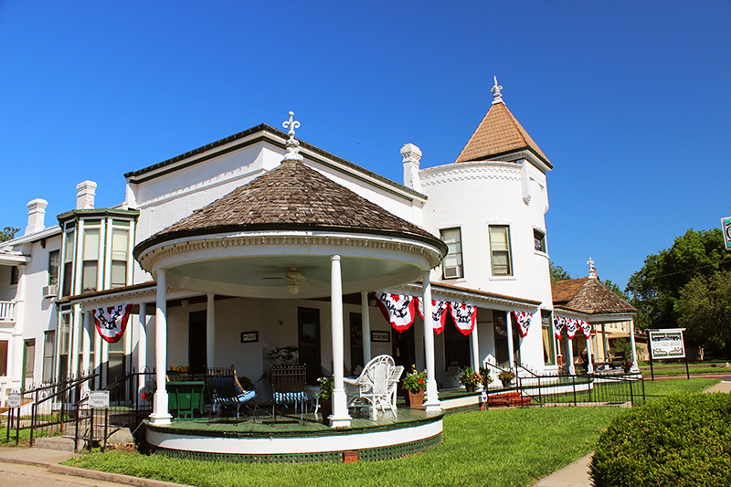
We sought out buildings and businesses that were active during the trail days. Here is the Cottage House Hotel of Council Grove, Kansas. We stayed here for two days, as this little town is one of our favorite spots and is entirely a Santa Fe Trail National Historic Landmark. Cottage House was in business and lodged many people heading west. The town boasts over 24 sites that are easy to find and explore.
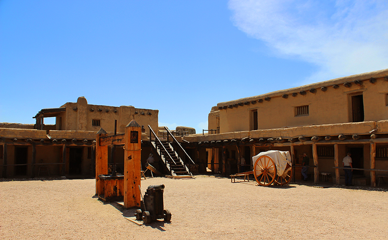
On our journey, we past several outposts and forts built to give protection to travelers along the Santa Fe Trail. Over time, the original wood and adobe buildings fell into ruins, but some were wonderfully restored. Here above, we toured Bent’s Old Fort in Colorado, inhabited from 1833 to 1849, and was the only major American permanent settlement on the Santa Fe Trail between Missouri and the Mexican settlements. It was re-built by the National Parks Service to the precise blueprint and measurements of the original fort.
Another fort not to be missed is Fort Larned in Kansas, which operated from 1859 to 1878. The original sod and adobe structures decayed and were replaced with the sandstone buildings that make up the fort today. And of course, Fort Union, only a hundred and ten miles from Santa Fe, operated as a frontier post from 1851-1891. Also visible at Fort Union are an amazing network of ruts/swales from the Mountain and Cimarron Branches of the old Santa Fe Trail. (There were two routes to take on the trail, so we traveled both.)
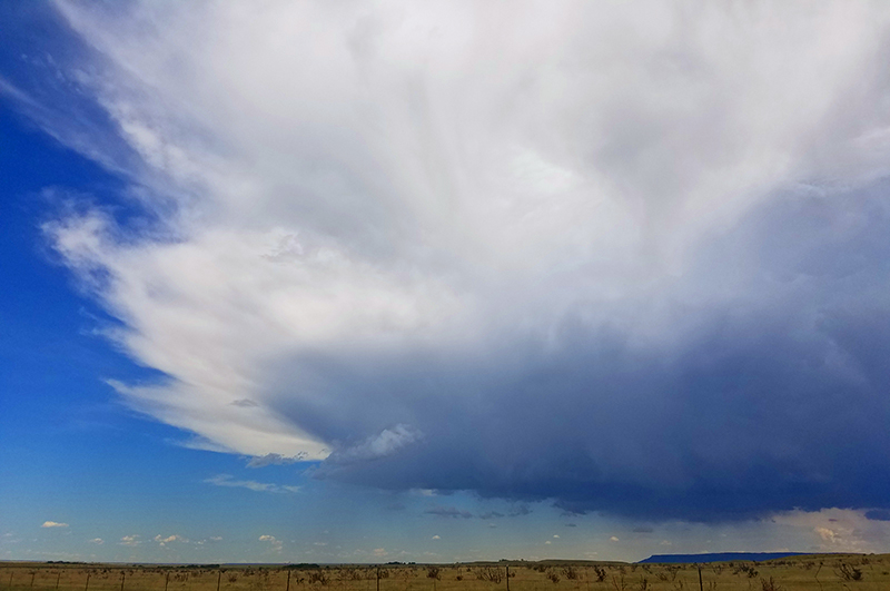
As we reached the wide open prairies of Kansas and deserts of New Mexico, the skies appeared to be bigger. We also were sure to check the weather each morning and evening because the SFT goes directly through America’s Tornado Alley. One morning we made a hasty getaway to outrun a twister in central Kansas.
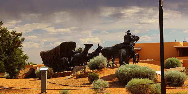
Along the Old Santa Fe Trail at Museum Hill of Santa Fe stands “Journey’s End,” – a huge bronze sculpture of a mule team struggling to pull a Conestoga wagon. It is a magnificent work of art, and once you find it you realize you are only minutes from the trail’s end … just as people traveling the original route would have known when they reached this very spot.
After cataloguing thousands of photos and videos from our two+ weeks on the trail and constantly talking about our adventure, we decided to create a photo and video tour of our favorite moments and discoveries in the format of a guide book. It’s a big project and we will be sharing our progress and more tips on where to go, what to see, and stories along the way as it comes together.
Wishing you Happy Discoveries!
Amy & Mr.D
If you liked this article you may also like …
The Oldest House in Santa Fe, and the Oldest Church in the Continental United States

16 comments
Very interesting
Thank you. More to come.
Looking forward to the travel guide. This is a trip we would love to take. Can it be done in ten days?
Nan, yes you can make the trip in ten days and if you’re on a one-way trip we would suggest the upper mountain route. To really experience the trail it would take months to stop at all of the sites and discover their significance, the museums, historic towns and homes, and the many markers and rut sites. That’s why we have constructed the guide to cover 5 places everyone must see, and then offer 100+ in-between sites so you many choose those that appeal to you and your schedule. Also, traveling in the spring and summer months with longer days will give more daylight hours for discovering. Happy trails!
I have seen signs for the Original Trail Route many many times and always thought it was a cattle trail! This is a wonderful project and I cannot wait to see all of the sights you discovered!
Gemma, it’s so much more than we’d imagined. Thank so much!
I’ve jut looked up Council Grove and see why it has become a favorite site along the Santa Fe Trail. It was the last stop for supplies before the wagons headed on west and they have a Last Chance Store there. You could get at least 1 year of history lessons just from staying in this one town. I can’t wait to see your tour book.
Carmen, we would recommend at least 2 days to discover Council Grove. First thing when you arrive, get their SFT map with all of the sites noted for a driving tour. Most all of their hotels, restaurants and museums have this map … it covered everything we’d planned on seeing and made for an easy to follow self-guided tour.
Wow these are great photos! Looking forward to the guide book and more trail sites to see!
True Blue, we are so excited to complete the book. There is so much more to the trail than we’d imagined to find.
Amazing how the landscape changes on this 900 mile trail. Had no idea what the Santa Fe Trail was and now am very intrigued.
Sammie, it was so much more than we’d anticipated. And the people along the trail are fascinating.
Channeling all good thoughts to you as you write your book. From viewing just these photos it looks to be beautiful. From reading about your adventures, it promises to be educational and exciting.
ChileSage, it’s a big project to take on but this trip was so extraordinary and educational – we have to share it. Thank you!
Holy crap, I had no idea it wasn’t a cattle trail. I can’t wait to see the video and explore this new discovery. How marvelous!
Gracie, we know! We thought it was a cattle trail for the longest time. Stay tuned for more trail stories.